
Trace a St. Clair Shores Street
Address work in St. Clair Shores is strongest when it follows the record chain in order. First, use USPS ZIP Lookup to check the delivery form, including a unit when one belongs in the address. Next, use the Macomb GIS guide to locate the parcel. The map connects a street address with a tax ID, community value, and legal description. Those details are more useful than a street name alone when a property has an alternate or legacy address string.
Ownership display and occupancy are different things. The St. Clair Shores Assessor maintains parcel maps, boundaries, legal descriptions, ownership changes, building characteristics, exemptions, and assessment-roll access. The next source is the recorded deed, which supplies a dated conveyance trail. A voter lookup and a dated directory can help with distinct questions, but neither turns the parcel record into a list of everyone at an address.
- Normalize the street, unit, city, and ZIP with USPS, while retaining the source spelling in research notes.
- Search the parcel by property address, intersection, tax ID, or all known addresses in Macomb GIS.
- Record the tax ID, property address, community, legal description, subdivision, and lot before changing search tools.
- Open the city assessor or BS&A record for the current assessment and publicly visible building, tax, or permit details.
- Use the legal description, parcel, address, and recorded party names in the Register of Deeds index.
- Follow a deed reference backward one documented instrument at a time, noting any unscanned-book or spelling gap.
- For older occupancy research, use dated reverse directories, newspaper indexes, yearbooks, census releases, and probate records through their custodians.
Note: Preserve the source and date for each step because an address, an assessment display, and a recorded deed can describe different moments.
Search St. Clair Shores Street Parcels
The GIS search is the bridge between a street address and land records. The county guide permits an intersection search, a full or partial tax-ID search, a property-address search with community autocomplete, and an all-known-address search. It advises leaving off a suffix such as RD, DR, AVE, BLVD, or CT when an address search misses. A successful result shows the tax ID, property address, and community. Selecting the tax ID opens legal-description and local-tax links and zooms to the parcel.
Use the map to orient a search, not to claim a household roster. The guide documents parcel boundaries, map printing, selected data, scale, and local tax-assessing links. It does not document a one-click street roster or a radius tool. A visible adjoining parcel can be researched in its own right, but a parcel boundary does not establish who occupies the property.
| GIS search option | Input | What it resolves |
|---|---|---|
| Intersection | Street and cross street | A location when the street number is unknown |
| Tax parcels by Tax ID | Full or partial identifier | A particular parcel, with broader results for a shorter ID |
| Tax parcels by property address | Address and community | Street-address match with a community field |
| All known addresses | Address string | Alternate or legacy address strings attached to a parcel |
Use St. Clair Shores Street Records
The city-linked BS&A portal has service areas for assessing, building, current tax, utility billing, miscellaneous receivables, and all records. The city says it offers no-cost, around-the-clock property details, while assessment records may also be inspected through Tax, Water & Assessing at City Hall. The assessor says it keeps 20 years of assessment rolls. Call before an in-person visit because staff may be in the field, and allow up to two business days for detailed questions.
The published BS&A search guidance documents the following fields. It is a general guide, so it does not prove every module or historic record behaves the same way for St. Clair Shores.
| Field | Type | Required | Format or use |
|---|---|---|---|
| Address or range | Text | Optional for address mode | An address or range such as 100-200 Main St; advanced address search is documented |
| Owner or name | Text | Optional for name mode | First and last name; a match can span parcels |
| Parcel number | Text | Optional | Use the portal format; the city mask was not posted |
| Utility billing account | Text | Optional | Account or location identifier in that module |
| Building record number | Text | Optional | Permit, enforcement, certificate, or project number |
| Service or module | Selector | Portal dependent | All Records, Assessing, Building, Current Tax, Receivables, or Utility Billing |
Do not treat a current assessment display as a certified deed. Capture the assessment year and the field labels visible in the live result. The reviewed public pages do not post city-specific historical-image coverage, a universal parcel-card layout, or a full results-export description.
Follow a St. Clair Shores Deed Chain
The Macomb County Register of Deeds records deeds, mortgages, liens, lis pendens, and federal tax liens. Its online land registry begins with registry selection and supports the county’s documented land-record route. The county describes free basic online search, a paid document-copy route, advanced subscription searching by address, legal description, parcel, or name, and scanned images available at public terminals and sometimes online.
For a parcel search that reaches past the current owner display, take the legal description to the deed index. Record the registry selected, party name, document type, recording date, document number or book/page, and image availability. Then read the prior-instrument or grantor reference in the deed and repeat. A grantor is the person or entity transferring an interest; a grantee receives it. A lien or lis pendens is a filing, not a final court outcome.
A Macomb land-registry screen is the entry point for a recorded-document search.
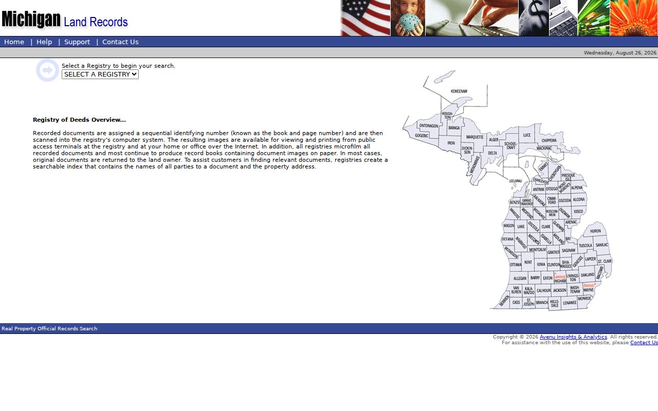
The image shows why the selected registry and search terms belong in the research notes before a document trail is interpreted.
If an image or older instrument is not online, the documented alternatives are the Register of Deeds public terminals, record books or microfilm, a staff search, and a mail request. A written request needs the record type, parties, approximate date, address or legal description or lot, a stamped envelope, and payment. The county lists staff searches at $5 per search plus $1 per page, and the Land File Office can provide taxpayer name or address help by phone at 586-469-5313. The county does not post a single oldest online-index or image year.
St. Clair Shores Street Directory Sources
These address-keyed sources answer different parts of a street question. Start with the parcel and keep the record type visible in your notes. An owner-of-record field, a permit, and a dated directory entry should not be merged into one conclusion.
| Address source | Custodian | Useful field or record | Access channel |
|---|---|---|---|
| Parcel and GIS | Macomb GIS | Tax ID, address, community, legal description, parcel geometry | Public map, search, and print tools |
| Assessment roll | St. Clair Shores Assessor and BS&A | Assessment, ownership display, building facts, exemptions | Online portal and City Hall inspection; 20 years stated |
| Recorded instrument | Macomb Register of Deeds | Parties, instrument type, legal description, recording date | Online, public terminal, staff search, phone help, or mail request |
| Permit | City Community Development & Inspections | Address-keyed work, permit, or project record | BS&A Building module or city department |
| Code record | City Code Enforcement | Service request, inspection, notice, citation trail | Service request or FOIA route |
| Voter record | Michigan Department of State and Macomb Elections | Individual status or fields available through a lawful list request | MVIC lookup or county and state request forms |
| Historical directory | Library and archive collections | Dated address-to-name listing | Index, collection, microfilm, or archive access varies |
Note: A street address can return a tax mailing address that differs from the physical parcel, so label both instead of silently substituting one.
Read St. Clair Shores Address Terms
Property records use labels that look alike but do different work. Reading them precisely helps a St. Clair Shores street directory search stay tied to the right parcel and date.
- Parcel or tax ID
- The identifier assigned to a piece of land in the tax and GIS system. The GIS guide gives 14-22-452-004 as a St. Clair Shores example.
- Situs address
- The physical location of the parcel. It can differ from the mailing address on a tax record.
- Legal description
- The subdivision, lot, plat liber and page, or other land description used to identify the property in records.
- Plat
- A recorded map that lays out lots, blocks, streets, and related land divisions.
- Criss-cross directory
- A dated reverse-style directory that starts from an address rather than a person’s name.
Older research also needs a date label. The creation date, recording date, index date, image date, and portal-publication date can all differ. A newer web result may point to an older instrument, while a paper book may have no web image at all.
Check St. Clair Shores Street Changes
The City Building Department handles building, plumbing, mechanical, electrical, fence, driveway, and other permits through Community Development & Inspections. Search the BS&A Building module first. For records not visible there, contact the department at City Hall. A permit can date a project or improvement, but it does not establish that a named person lived at the property.
The Code Enforcement office accepts service requests that require an address. The city says follow-up is generally seven to ten business days and may lead to correction notices, citations in 40th District Court, or tax-roll liens. For a discrete city record, use the city’s FOIA request procedure. Michigan FOIA uses a written-request process, generally with a five-business-day response and a possible ten-business-day extension.
Place St. Clair Shores Streets in Context
The 2025 street index and map is useful for road orientation, civic locations, precincts, school boundaries, and voting locations. It shows the 8 Mile through 14 Mile road band, Jefferson Avenue, Greater Mack, Harper, I-94, I-696, parks, and lakefront access. It is not a parcel-history source and it does not prove a ZIP boundary or a resident’s connection to a district.
Planning descriptions use names such as Nine-Mack Downtown, the Nautical Mile Marina District, Nine Mile Corridor or Motor Mile, Poplar Beach, Civic Campus, Grove Pointe, Ardmore Park, and Eastland Woods. These are useful search terms in a city packet or planning record. They are not automatically postal areas or legal neighborhoods. This geographic distinction matters because 48080, 48081, and 48082 are delivery geographies, while a parcel is tied to its GIS community and legal description.
Limit a St. Clair Shores Street Directory
The Michigan Voter Information Center is an individual registration and polling lookup. Its name route requires first name, last name, birth month, birth year, and ZIP. It is not a free street-browse tool. Macomb’s voter-list form offers specified jurisdiction and election choices through a formal request route, while protected fields remain withheld. Michigan does not register voters by party.
Public parcel records also cannot establish non-owner occupants, household members, visitors, mail recipients, utility customers, protected voters, DMV addresses, or a current resident from a historical listing. A local group’s public contact page is not a membership roster. When older occupancy matters, treat reverse directories, newspapers, and obituary indexes as dated leads and verify them against the original record.
Lawful use. St. Clair Shores address records are for personal, lawful research and source verification. Michigan’s stalking statute covers repeated harassment and unconsented contact, so records must never be used to stalk, harass, or intimidate anyone.
For a past household, use a dated listing through the St. Clair Shores Directory Book rather than treating the current street record as historical proof.