
St. Clair Shores ZIP Code Directory Coverage
The Michigan ZIP map and the Legislature post-office list identify 48080, 48081, and 48082 with Saint Clair Shores. The reviewed city and state materials do not publish a reliable street-by-street boundary for any one of them. That is why every address needs a full-address USPS check, rather than a guessed cross street or a broad neighborhood label.
| ZIP | Areas covered | Postal use | Source note |
|---|---|---|---|
| 48080 | Saint Clair Shores delivery area | Standard city ZIP | Exact street limits and adjacent-municipality overlap were not located |
| 48081 | Saint Clair Shores delivery area | Standard city ZIP | Verify the whole delivery address with USPS |
| 48082 | Saint Clair Shores delivery area | Standard city ZIP | Exact street limits and adjacent-municipality overlap were not located |
These are postal delivery areas, not a claim that each ZIP ends at the city line. Keep the original address string in notes, including any directional, suffix, historic spelling, or apartment or unit. Make a separate normalized display string for the street number, street name, suffix, directional, unit, city, state, and ZIP.
Verify a St. Clair Shores Delivery ZIP
USPS provides three useful paths: By Address, By City and State, and Cities by ZIP. Use the first when a complete delivery address is known. Use the city-and-state route to check the postal naming form, and use Cities by ZIP to see the postal cities associated with a code. USPS warns that a result does not confirm a person or company. It normalizes delivery information, not a resident record.
A USPS address and ZIP lookup shows the available postal search modes.
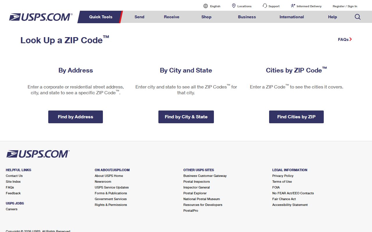
The postal check belongs before a parcel or voter search so that a wrong city spelling, missing unit, or stale ZIP does not travel into later records.
For a record trail, preserve both versions: the source text as received and the USPS-normalized display address. Do not silently remove a unit because a parcel screen has only a tax address. A tax mailing address and the parcel’s physical address can differ, even when each is accurate for its own purpose.
Note: Record whether an address came from USPS, GIS, BS&A, a deed, a city map, a court form, or a historical directory.
Check St. Clair Shores ZIP Search Fields
The Michigan Voter Information Center uses ZIP as part of an individual lookup. It is not a ZIP-wide directory or a street-browse tool. In name mode, it asks for a first name, last name, birth month, birth year, and five-digit ZIP. An alternate route uses a driver-license or state-ID number, which should not be shared or used as a public matching key.
| MVIC field | Type | Required | Use or limitation |
|---|---|---|---|
| First Name | Text | Required in name mode | Enter the individual’s first name |
| Last Name | Text | Required in name mode | Enter the individual’s last name |
| Birth Month | Dropdown | Required in name mode | Month selector; day is not requested |
| Birth Year | Text or number | Required in name mode | Year input |
| ZIP | Text or number | Required in name mode | Five-digit delivery input |
| Driver License or state ID | Alternate text path | Only in alternate mode | Do not publish the number |
Results may show registration status, polling place, sample ballot, subscriptions, or absentee tracking where applicable. Michigan does not register voters by party. Protected fields include full driver-license or state-ID numbers, month and day of birth, phone, email, signature, Social Security number, and registration-office information.
Narrow a St. Clair Shores ZIP Search
A ZIP narrows a known address or an individual voter-form entry. It does not replace the parcel field that links property records. The generic BS&A guide documents address, name, parcel, utility-account, and building-record criteria, but it does not promise a ZIP filter. The Macomb GIS guide uses community, address, tax ID, and intersection paths, not a ZIP field. Treat any ZIP-filtered output as a lead that still needs USPS and parcel-community confirmation.
- Run the complete delivery address through USPS and retain the result with its date.
- Use the ZIP only in a system that documents it, such as the individual MVIC form.
- Search the Macomb GIS parcel workflow by address, community, tax ID, or intersection to identify the parcel.
- Check the St. Clair Shores Assessor and city-linked BS&A record for property fields that are publicly visible.
- Keep the USPS delivery label, GIS community, and legal description as separately sourced facts.
Once an address is narrowed to a particular street, the St. Clair Shores Street Directory has the parcel-to-deed workflow. It is better suited to a street-by-street property question than a postal code alone.
Read St. Clair Shores Postal Geography
ZIP geography, city limits, school districts, voting precincts, and parcel communities are different boundaries. A mailing address can use Saint Clair Shores while a parcel, court, or tax record uses a different community value. The reverse can also happen when USPS normalizes a city string differently than the city record. Matching the postal form to the GIS community keeps the distinction clear instead of choosing whichever label looks most familiar.
This is especially important across the city’s road, shoreline, and civic geography. The city map identifies precincts, school districts, roads, parks, civic locations, and lakefront access. Planning records use labels such as the Nautical Mile Marina District, Nine-Mack Downtown, Poplar Beach, Civic Campus, Grove Pointe, Ardmore Park, and Eastland Woods. Those are useful location terms, but they are not evidence of a ZIP boundary or a legal neighborhood.
Boundary warning. A ZIP check supports mail delivery only. Confirm the GIS community and legal description before treating a St. Clair Shores address as a city parcel or record jurisdiction.
Use St. Clair Shores Map Boundaries
The city’s Maps & Property Information gateway points researchers to BS&A, Macomb GIS, and the county deed-search registry. That is a useful transition after a postal check because it moves from delivery information to the record systems that hold parcel and recorded-land details. The GIS guide documents property-address search, community autocomplete, tax-ID search, all-known-address search, legal descriptions, and map-print controls.
The city property-information links gather those official starting points in one place.
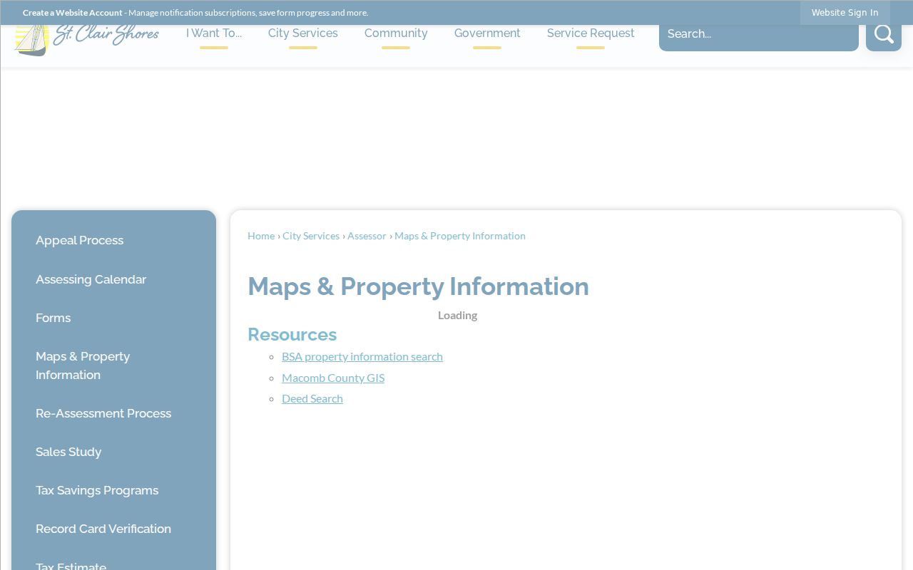
The gateway helps separate the delivery ZIP step from later parcel, assessment, and recorded-document research.
For civic orientation, the 2025 St. Clair Shores street index and map is the source for roads, precincts, school boundaries, and voting locations. It does not draw authoritative postal boundaries, so it should not be used to assign a ZIP street by street.
Match St. Clair Shores Parcel Labels
Parcel research needs more than a delivery address. Macomb GIS can return a tax ID, property address, community, legal description, Bird’s Eye View, local-tax-assessing link, delinquent-tax report link, and printable selected data. The city assessor maintains ownership changes, parcel maps and boundaries, legal descriptions, building sketches and characteristics, exemptions, and tax-relief information. These are property fields, not a continuous record of every person who may have received mail there.
The key terms are simple but important:
- ZIP and ZIP+4
- A ZIP identifies a broad delivery area; ZIP+4 adds a more specific mail-routing segment. Neither replaces a parcel ID.
- PO-box ZIP
- A code assigned for post-office-box delivery. It does not describe a physical residence.
- Unique ZIP
- A ZIP used for one organization or delivery arrangement. None was identified in the reviewed St. Clair Shores source set.
- Carrier route
- A mail-delivery grouping used by USPS. It is not a city limit, precinct, or parcel boundary.
- Situs address
- The physical parcel location, which may differ from a property-tax mailing address.
Treat St. Clair Shores ZIP Counts Carefully
The city’s 2024 community survey recorded respondent ZIP distribution: 48080 had 319 responses, 48081 had 288, 48082 had 224, and 39 respondents said they were not residents. Those figures are a survey response pattern, not a USPS delivery count, a Census population estimate, or a measure of how many people live in each ZIP. They should not be used to rank the ZIPs by population or to infer a household count.
Research also changes over time. A postal result is a delivery snapshot, an assessment record is tied to its assessment year, and a deed has a recording date that may differ from its execution date. Marking the source date makes later verification much easier.
Limit a St. Clair Shores ZIP Search
A delivery ZIP cannot identify a resident, confirm a company, prove city residence, establish a property owner, or show every address in an area. The limits matter most when information comes from different systems. USPS supplies delivery normalization; GIS links a parcel to a community and legal description; the assessor supplies current property information; and recorded documents establish a distinct dated land record.
When the online path stops, use the channel that holds the record. Assessment records may be inspected through Tax, Water & Assessing at City Hall, while the city-linked BS&A portal supplies the public property starting point. The Macomb Register of Deeds offers basic online search, public terminals, staff searches, and mail requests for recorded land documents. Older or unclear results may require record books, microfilm, library indexes, or a direct question to the county office rather than a ZIP-based guess.
Use the source that matches the question, and do not infer more from a shared code than the source supports. For personal, lawful research, confirm a match through the original custodian and keep protected addresses and private details out of notes that will be shared.